Nestled in the core of my practice is a desire to find ways to perceive and imagine our interconnectivity with the world we live in. The idea of Aesthetic Subjectivity is my master concept for this desire and I try to find creative arts approaches that develop this sense of connectivity. It still surprises me just how many different ways we are entwined with our environment, near and far.
The following account is long, but this project is kinda massive and really damn cool!!
Watching Rage a year or two ago I saw an Aussie Band playing on the ground and rapidly pulled out into an aerial view. By the end of the clip the footage showed the arc of the earth against the darkness of space. It was pretty cool and my husband Dean and I puzzled over just how it was done. Not too long after this we watched an episode of the ABC’s science show Catalyst. Here a team in the Arctic were launching a helium filled weather balloon and GPS to collect atmospheric data. The penny dropped and so began the Google search to figure out how to do this crazy thing myself…
The Concept
Originally conceived as part of my PhD research this Weather Balloon Camera idea seemed quite complimentary to another project I was developing, the Kitchen Table Art Expedition at Macarthur Primary School. I put the concept to the school principle and she was keen to give it a shot. It works like this:
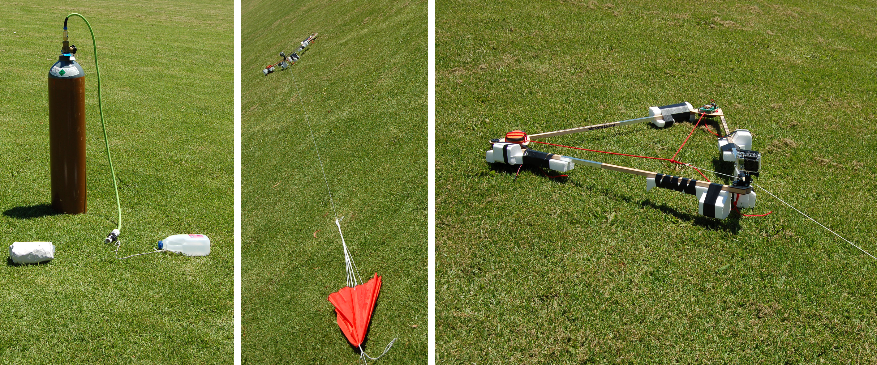
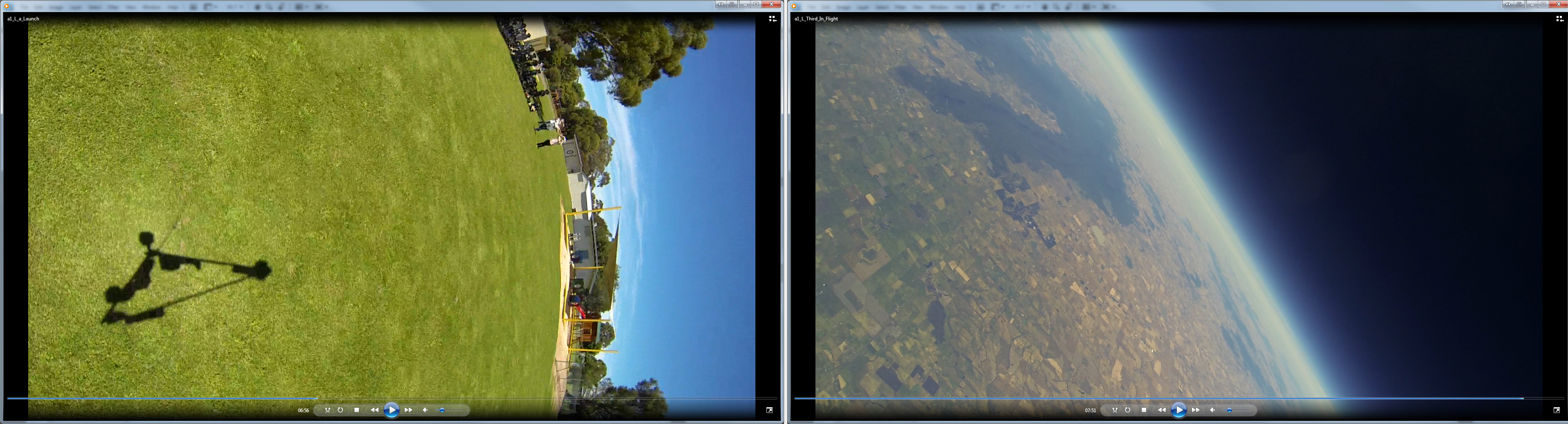
A camera and GPS are attached to a Weather Balloon which is filled with Helium. The Helium pulls the 6ft Balloon skyward reaching an altitude of about 80,000 (Seriously!!) into an area of the atmosphere called the Stratosphere, about halfway to space. Because the air is so much thinner at this height the helium stretches out and expands, enlarging the balloon to a 20ft diameter at which point it bursts. This causes the Camera set-up to fall back to Earth, the rapid descent opens up a Parachute to slow the fall. GPS Tracking theoretically allows the Camera to be retrieved.
My idea was that letting the students at Macarthur experience making this footage would help them to imagine themselves as part of the bigger world of Earth. I called this sub-project “Gaia is Symbiosis as Seen from Space” after the phrase coined by a student of the famous micro-biologist Lynn Margulis. Gaia (a name originally meaning Goddess Mother Earth) is the name given to our planet, Earth, when thinking of it as an integrated ecosystem http://en.wikipedia.org/wiki/Gaia_hypothesis . The idea in this phrase being that we can imagine Earth as an interconnected organism when we view it in the totality afforded by a bird’s eye view from space.
So we began the Kitchen Table Art Expedition back in April this year as my previous posts attest. Gaia is Symbiosis… was meant to provide us with a conceptual starting point, it was to be our first event and the retrieved footage was going to inspire the student’s artistic process. It turned out however that there was a lot more involved in launching a “Near Space” Camera than just blowing up a massive balloon. I learnt a bunch of stuff trying to piece the right equipment via the internet, like alkaline batteries quickly go flat at the -50o temperatures of the upper atmosphere… It took until late June to have the right equipment in my hands. I found a pre-made kit which included all the gear I needed (bar a GoPro Camera and Helium) and importantly a manual describing the process. It also recommended lithium batteries as they survive much longer in colder conditions…
The Preparations
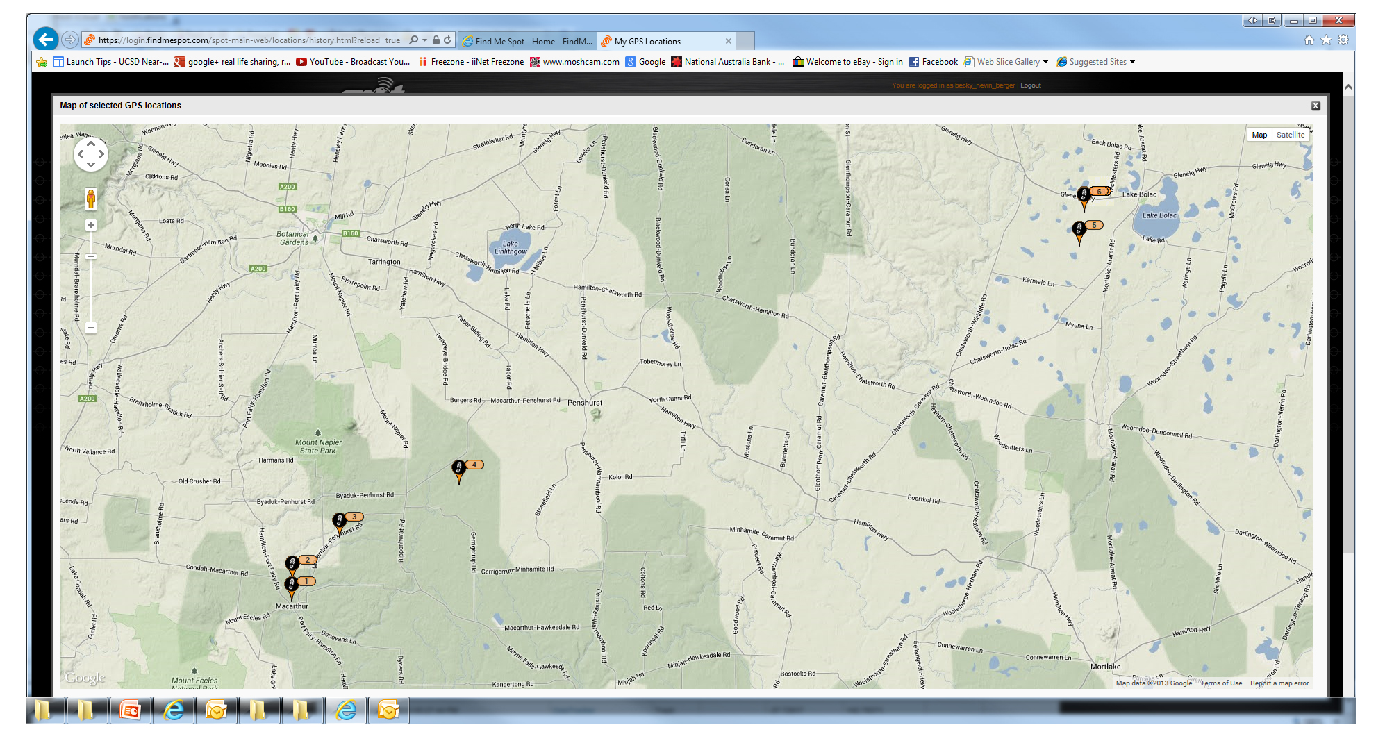
At this point it became apparent that our mission would require clearance from CASA, the Civil Aviation Safety Authority. This aspect of our preparation really got my head into the space of understanding what we were doing. I had to familiarise myself with the Air Safety Regulations for “Unmanned Aerial Vehicles” or UVAs and complete a detailed application to CASA. This included plotting a predicted flight path. This link shows how complex that weaving space just above our heads is http://flysafe.raa.asn.au/meteorology/section4.html . Whilst the winds on the ground may be doing one thing, the jet streams that blow above 30,000ft can be doing another thing all together and quite quickly at that!! Drawing on the formula in my kit’s manual I predicted that our flight would start in Macarthur and conclude North East from there near Lake Bolac. I worried that the 80kp/hr winds of the Jet Streams would flick us out to the Southern Ocean or into a rocky crevasse in the Grampians swallowing up our camera forever!! This link shows what the Jet Streams were doing last night http://www.wunderground.com/maps/au/jetstream.html
We gained CASA Approval by September and were at this stage in the later stages of the Kitchen Table Art Expedition. We had kept our Art’s Explorers informed throughout and now it was just a matter of getting great weather, clear skies and low winds, to align with our timetable. The last week of our project was not only hectic but coupled with strong winds and persistent rain. Sadly our launch was postponed and a long, overcast wet spring ensued. I had all but given up on our launch as had the students.
D-Day
An approaching high pressure system was forecasted in last week’s weather. I kept my eye on the Bureau of Meteorology website and decided that we should make a go for it. I got in touch with Macarthur’s new principle, located some Helium, called CASA , the Bureau of Meterology’s Aviation Desk and dusted off the Camera Rig… and began to shit myself just a little!! It was hard to believe we were actually going to give it a try. I metered my worries with my resolve that it was better to risk failure, be it a dud-launch or lost GoPro, than to never know what it was like to try. I love my Macarthur kids and I really wanted to this have a run at the impossible with them.
Tuesday December 17th, the first day of the high pressure system, was the only day we could launch. Morning in Warrnambool was overcast, I kept my fingers crossed. Three Black Cockatoos flew past my car, I hadn’t seen any since before winter, these dudes are my totem bird and I took it as a sign to stay calm and focused, the world was on our side. Driving the terrain out to Macarthur I crossed Tower Hill, out through farm land, volcanic planes and lava flows, past eucalypt plantations and wind turbines, all the while feeling a growing sense of connection to the breathing landscape I was in. The sky was still overcast. Coming through Orford I felt it was time to speak to the land, I knew I had to ask the Aboriginal ancestors for permission. I acknowledged the Gunditjmara as the traditional custodians of this land and communicated my gratitude to Ancestors Past, Present and Future and asked for the blessing to complete our project. I felt the heat on my driving arm immediately, the sun was beginning to disperse the clouds, I felt I had been heard with love. I also made the Sign of the Cross just to keep all bases covered. Another two Black Cockies, and Eagle on a sign post, I was almost in Macarthur, the clouds kept breaking up…

As I set-up the equipment on the School Oval another three Black Cockies flew across, their graceless squawking warmed my heart. We were going to be fine! I enlisted the help of both the current and newly retired principles in the tricky task of filling and tying off the weather balloon. I also roped in two school Mums with abrupt notice. The balloon is delicate; if it touches the ground a simple blade of grass could cause it to prematurely rupture, as can groping or pinching it- we had to steady it with the palms of our hands. We each wore latex gloves as the natural acidity of our hands can weaken the balloons latex causing it to break in lower altitudes. It takes about 125 cubic feet of helium or the equivalent of about 250 standard balloons to fill this 5ft Weather balloon. Sealed and attached to the parachute line, the whole school counted us down, up went the balloon, followed by the closed parachute it pulled up the Camera Rig…. about ten meters into the air and then dropped it back to the ground- not quite enough helium we concluded!!

We commenced the careful task of un-sealing the tie and refilling the balloon. We waited until the balloon could lift our counter weight a good meter off the ground with ease. This is an imprecise measure but the best that we have. Too little helium means we won’t reach the altitudes that will burst our balloon and return our “payload” to Earth, too much helium and our balloon will burst before reaching 80,000 ft.

Today we err on the side of too much. We tied the balloon off again. I connected the audio beacon and ensured that the GPS and Camera were on. The students counted down, up went the balloon again followed by the parachute line, pulling with much more force the Camera Rig from the hold of my hands. This time we have true lift off- the collective elation we feel is palpable, this is the coolest thing ever!!!

The balloon remained visible for at least 15 minutes in the perfectly clear sky above us- we wondered what it could see, I wondered if I would ever see it again! Actually though, I had decided, that won’t matter if I never see it again- it is simply amazing that we got this crazy idea into the air.
Tracking
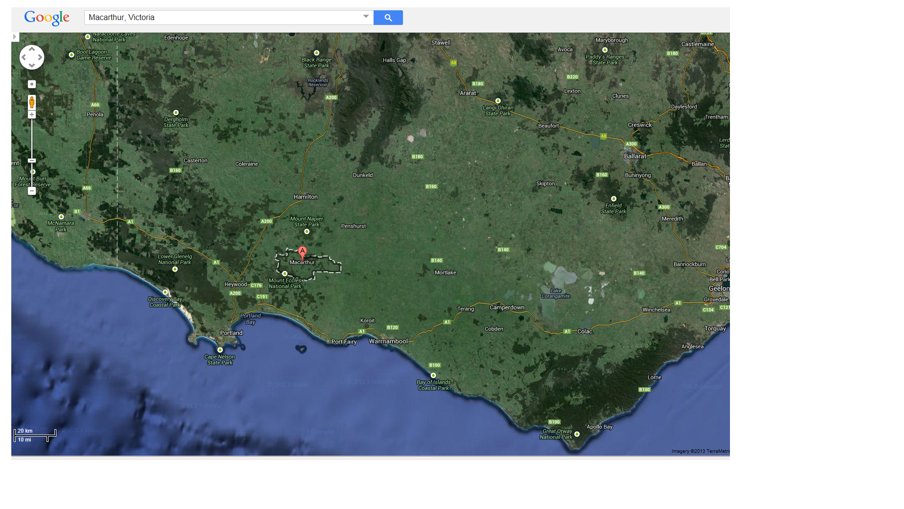
My husband, however, had a little less abandon about saying goodbye forever to our GoPro. He kept an eye on the website that allows the GPS Location to be tracked live on a Google Earth Map. The GPS Website is great. Whilst it doesn’t plot GPS locations above 10,000ft it does give us a pretty accurate indication of our course and amazingly it followed the flight path I gave to CASA. The Macarthur students are also able to watch the live tracking, at the 3:30 school bell they reported to me that our Camera had landed just shy of Lake Bolac. WOW!! A perfect outcome, I was pretty stoked.

Retrieval
I had expected to spend the following day driving the countryside looking for our camera. Instead I was able to leave directly from Macarthur and attempt to find it that same day. Up through Hamilton, through Dunkeld on the Glenelg HWY on a beautiful hot, sunny afternoon in my little blue hatch back on a mission! I headed up the dirt road toward the location on my GPS Map only to find that the part of the lane way I needed to access was private property. I had no luck at the couple of farm houses I approached so headed into Lake Bolac to see if anyone could help. It was after 5pm but a few good lads were still about in the workshop of their freight depot. I made my peculiar request, asking one if he knew how I could get into the paddock that was shown on the screen of my iPhone. I love country towns! He not only knew the spot, it was just near his place, but he knew the landowner. He rang him for me and I soon had permission and directions to get into the paddock where our camera appeared to be.

I walked with my iPhone and water bottle. The sun was still damn hot and I was not without trepidation. I got through the first paddock and out to the second toward the marker on my map. Sheep scuttled as I headed further in, looking for landmarks and expecting to see the orange parachute flapping about. I had an awful feeling that just the GPS was in this paddock, perhaps it had come loose on descent… I seemed to walk for ages and all I could see was grass and sheep. Then I heard a faint beeping, the audio beacon!! I had forgotten all about it! It was faint and the wind made it hard to sense which direction it was coming from but it was close….
Finally I saw it, frame complete with Camera and GPS (although held on by just one tie now), parachute and burst balloon splayed out with it.

Holy shit this crazy plan worked!! And here I was in a sheep paddock near Lake Bolac, on a beautiful hot December evening just after 6pm with the majestic Grampians gracing the horizon to the west. I uploaded a few pictures and announced my success via Face Book. This moment in time was the absolute upside of modern technology for me: physics, satellite infrastructure, affordable technology and artistic madness combined into a feat of wonder. It was damn tempting to stop in for a well earned cold one at the Lake Bolac Pub but I knew I had to complete my mission and get back to Warrnambool for some cold pizza and celebratory hugs!!
Taking it all in…
I did an epic circuit of the South West on our launch day. Warrnambool, Tower Hill, Macarthur, Hamiltion, Dunkeld and the Grampians, Lake Bolac, Mt Shadwell and Mortlake back into Warrnambool to my little house by the sea. I felt connection with the ancient geology of this volcanic ground, with the Indigenous Ancestors whose presence in the land is still strong, with the Macarthar crew who this grand mission was for, with the sense of country Australia that I grew up in through the generosity and humour of those lads at Lake Bolac. Most of all I felt a real sense of connection to my own spirituality, to that creative pulse that excites me and drives my imagination, to that sense that the world is bigger than that which is before my eyes, in many more directions than just the 3D. I really felt a part of the land, the sky and the universe through this event.

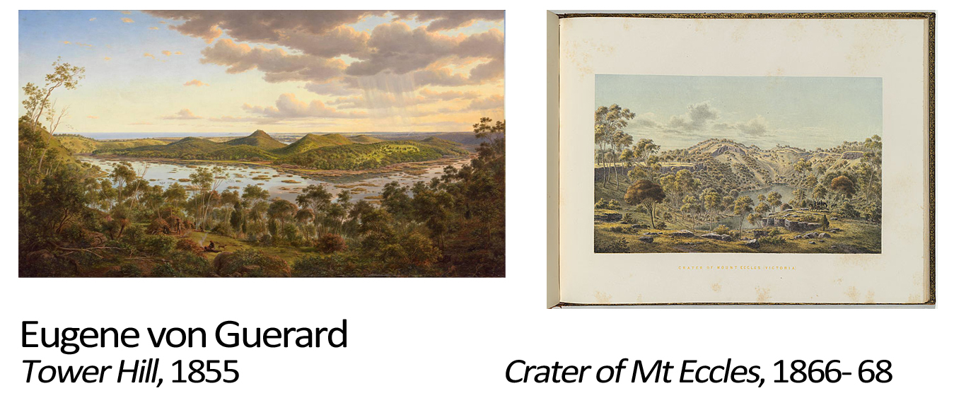
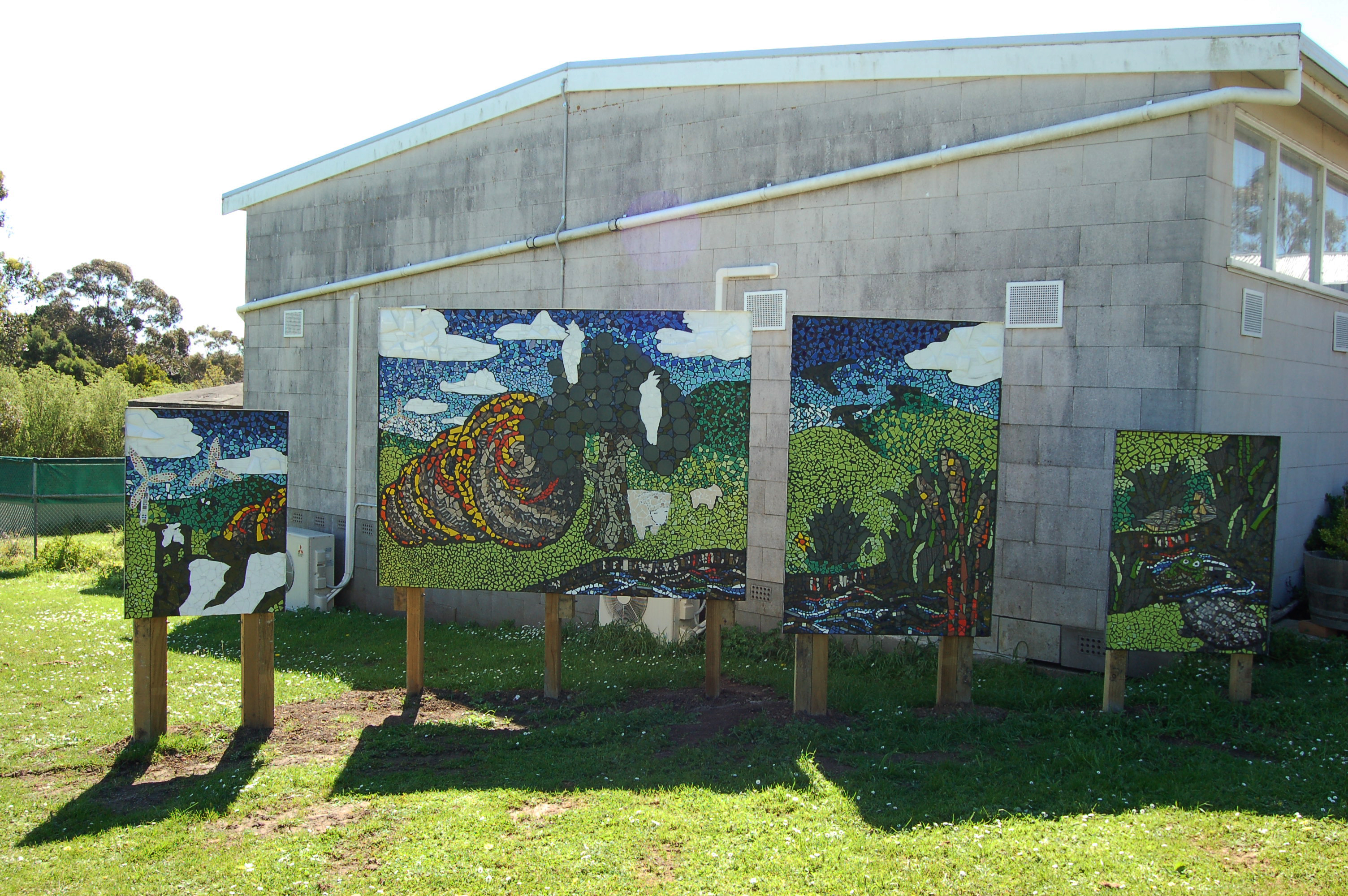
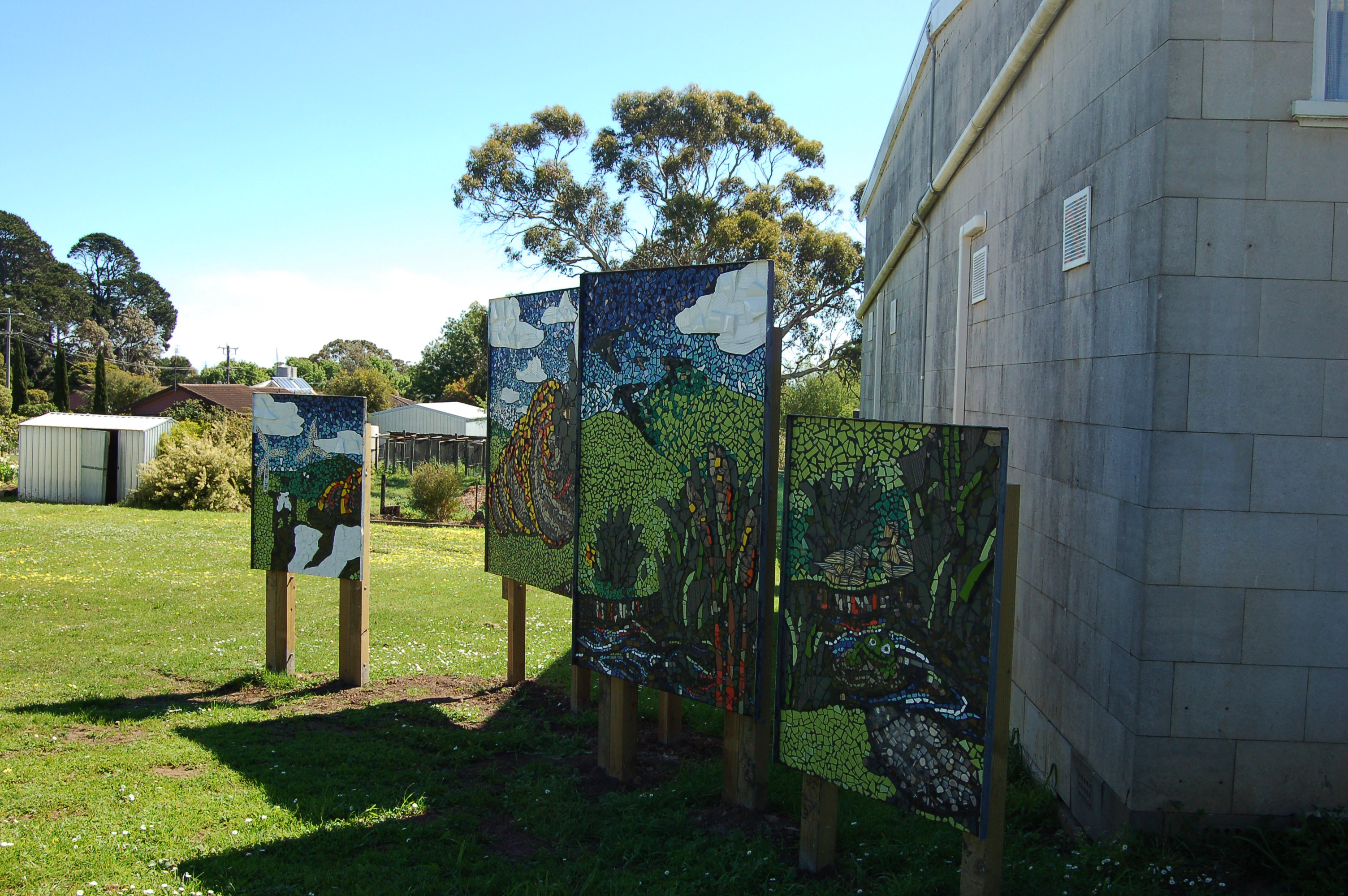
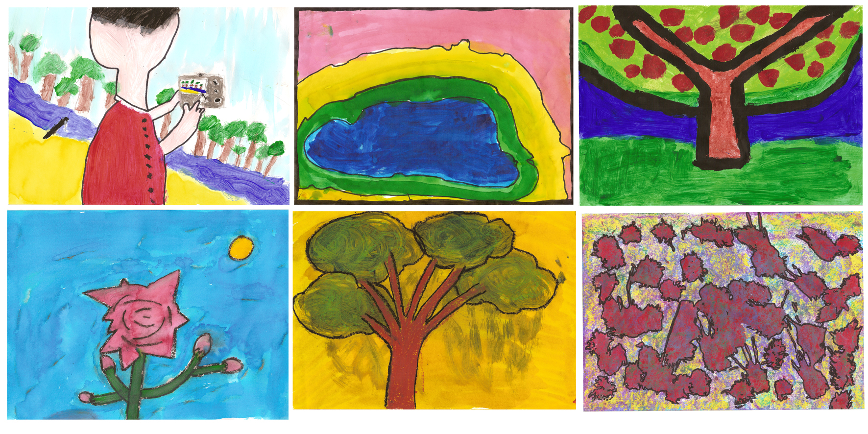
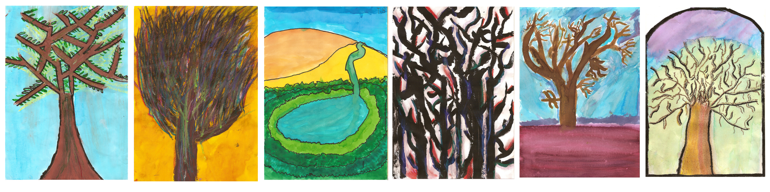
In lieu of starting the Kitchen Table Art Expedition with the launch of our “Gaia is Symbiosis… Camera” we visited Eugene von Guerard’s Tower Hill at the Warrnambool Art Gallery back in April. Under the methodology described by forefather of Ecological Science Alexander von Humboldt ( http://en.wikipedia.org/wiki/Alexander_von_Humboldt ), von Guerard had captured, in accurate detail and contrast, through paint and canvas the interconnection he observed in this new landscape. I believe that there is a poetic beauty in the way we were able to conclude our own, contemporary artistic examination of that same terrain 170 years later. We have used contemporary technology, scientific knowledge and artistic imagination and passion to find another way to imagine this same interconnectivity. From the blades of grass on the oval to the upper reaches of our atmosphere, this is the amazing planet Earth, our mother Gaia, the one place in the whole universe in which our lives are possible.

The footage is amazing. I spent the following day showing students at my own children’s school in Warrnambool excerpts and prepared a USB Stick which was sent out in time for the Macarthur Primary School concert that night. I haven’t heard yet, but I am pretty sure they got to watch it to. I really hope they did. The footage is exhilarating, I have loved watching the awe it inspires on everyone that has seen it so far…. this world is a wonderful place to live


We got about an hours worth of good footage before the camera stopped recording. I will edit it over the next week and post a link up to it soon.